No products
Prices are tax included
Altivario GPS
Last blog articles
Search on blog
Viewed products
-

Flymaster Altivario...
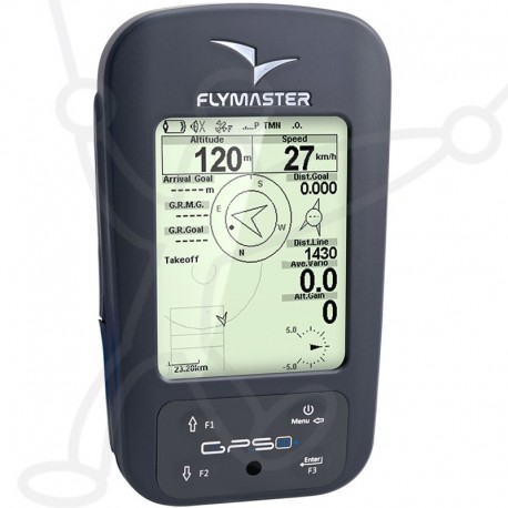
The Flymaster GPS SD+ is a new...
 View larger
 Flymaster Altivario GPS SD+
3-INS-FLY-GPSSDP
New product
The Flymaster GPS SD+ is a new intermediate GPS with integrated SD card which replaces the GPS SD. It inherits the architecture of its brothers the LIVE and NAV displaying "3D AIR SPACES" maps.
Battery life: 30 hours
Power supply: USB charging or AC 200 volts
Delivery time info per Email
More info
The FLYMASTER GPS SD+ is currently the best selling in its range.
With FLYMASTER DESIGNER software provided by the manufacturer, the pilot can design his own screens. He can place each data where he wants and the size he wants.
Far from being a gadget, this function allows everyone to adjust the display data to the reading ability of his eyes.
Much more robust than its predecessor, the case includes a scratch resistant screen.
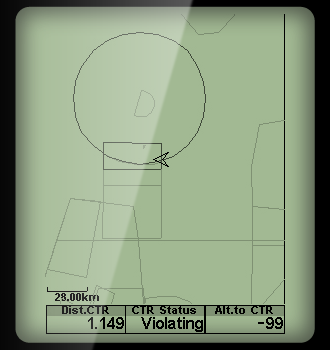 | Make no more mistake in airspace.With Flymaster 3D airspace warning system you will have ample information to navigate around restricted airspace zones. The Flymaster 3D airspace avoidance system provides tools to manage airspaces. Restricted areas can be seen in an embedded Map, or on dedicated page. The Map can be complemented with numerical, and text information using data fields. The Critical Airspaces dedicated page can be used to see detailed information about areas that are close to the pilot. | |
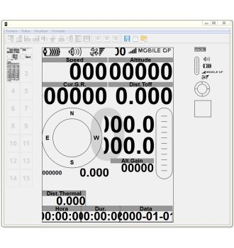 | Design your own instrumentNeed more or less data on your flight screens, with Flymasters' unique Designer you can create the instrument you like and need for your style of flying. Taking advantage of the Flymaster NAV SD graphic processor, which also allows grey levels and graphics definition increase, pilots can customize their own multiple screen pages using the new Flymaster DESIGNER.
| |
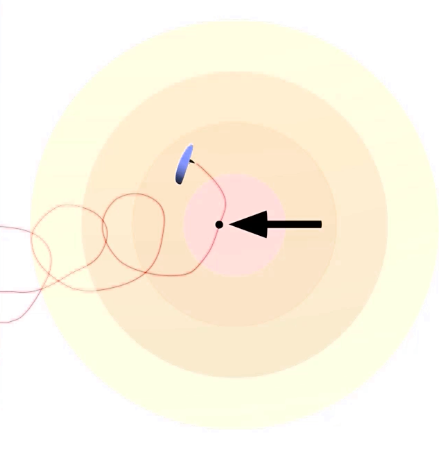 | Thermal efficientlyFlymasters' unique thermal ball will help you find the thermal core quicker and the zero buzzer make you don't fly past lift. The Thermal Core Map is one of the most useful, and exclusive feature of the NAV SD. This map corresponds to a black dot which is shown inside the inner navigation wheel. During a thermal climb the NAV SD keeps track of the strongest climb values and graphically represent the strongest one by a dot. The pilot can then search for a new core and if needed return to the last one by following the dot. | |
| ||
Main Features:
| Display Resolution (High Contrast Grey Scale) | 320x240 pixels |
| Screen size (true viewing area) | 76x57 mm |
| Battery Capacity (Lithium-Ion) | 4000 mAh |
| Autonomy Learn more | Approx. 35 hours |
| Size | 155x92x24 mm (Length x Width x Thickness) |
| Weight | 232 gr |
| GPS | 50 channels/4hz |
| Native USB Connection | Allows connection to the PC to download/upload Flight Data, Airspaces Data, etc |
| Battery Charging | From wall adapter, car adapter or standard usb port |
| Quad-band GSM | GPRS class 10. Quad-band support: GSM 850 MHz, EGSM 900 MHz, DCS 1800 MHz and PCS 1900 MHz |
| RF Interface | Allows the wireless connection of several external probes, like HEART-G or TAS probe, simultaneously |
| Micro SD slot | Supports cards to 16 GB, Optional pre-loaded 16GB SD card with airspace, ground data and maps now available |
| 6 Axis accelerometer and magnetometer | Allows 6-degrees of freedom Tilt-compensated Compass (available soon) |
| Firmware update by USB (upgrades are free) |




 Black Flyday on new ITV Piper 2Black Flyday on new ITV Piper 2